Saturday, June 30, 2012

Mt. Rainier Speed Run (on skis), 5:00.57

Two years ago Lars, Andy and I went on what we called a "Volcano Tour."  We all had a week off so we headed to the Pacific Northwest and skied as many volcanoes as we could.  Rainier was certainly one of the highlights of the trip.  That day we got a 3:30AM start and without focusing on speed were able to summit and be back in Paradise by 11:30AM.  Eight hours round trip wasn't blazing fast but we figured we should be able to go closer to four hours round trip given the opportunity to try and race it.  

Fast forward two years and Andy and I found ourselves with an unexpected three days off.  The Rainier forecast was less than ideal.  It called for snow and rain likely through Thursday night, with snow and rain and mostly cloudy skies likely on Friday morning.  We figured that, as we say regularly, we might as well go check it out.  As we were leaving SLC I thought we had a 10% chance of success, Andy guessed 5%.  Either way, we weren't too optimistic. 


We pulled into Ashford Thursday evening and packed up for the next day.  With the unsettled forecast we discussed hauling up extra safety measures.  We loaded a rope, prussiks, full avy gear, puffy, extra pants, extra gloves, hand warmers, headlamp, ice screw, tibloc, crampons and ski crampons. Not exactly light and fast but not too bad.  

Dorky smile, about to start in the rain
After a solid 8 hours of sleep and a fake alpine start (5 AM wake up), we drove up to Paradise in the daylight.  Leaving the Bunkhouse in the light with full intentions of summiting felt a little wrong. But we didn't have permits and had to wait for the ranger station to open at 6AM.  A quick chat with the rangers had us even less optimistic.  They said the snow was slush until 10,000' and that Camp Muir was still in the clouds.  Again, we figured we might as well go take a look.  The whole time we hoped that the clouds would break and we would find a sunny summit.  

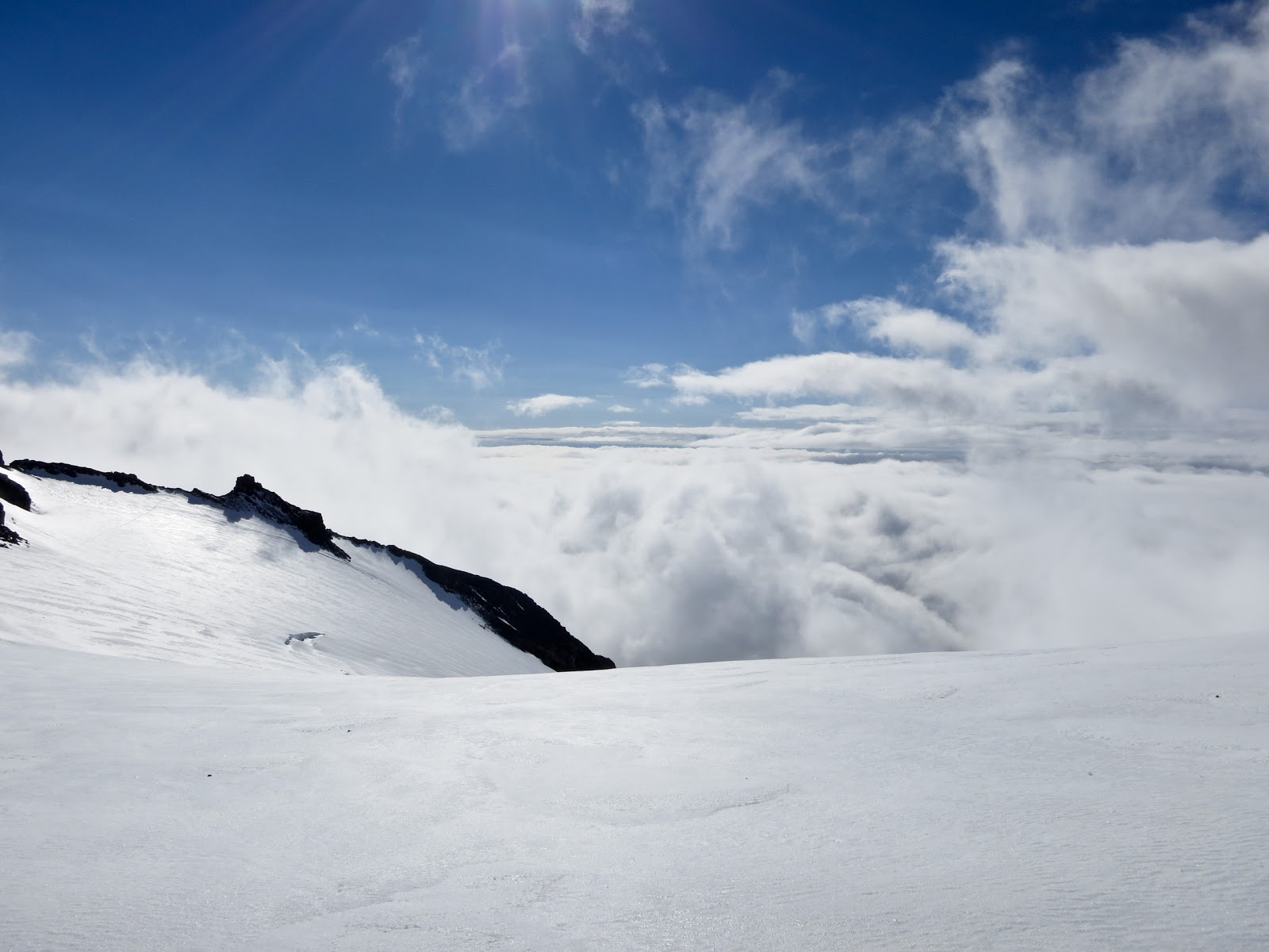
The way up to Camp Muir was as slushy as expected.  What we didn't expect was the lack of snow.  There were 4-5 rock outcroppings that required a transition from skiing to booting.  We just pulled skies as quickly as possible and kept moving.  On the Muir the incoming skies looked threatening until all of a sudden we could see the outline of the sun through the clouds.  A few minutes later the entire upper mountain appeared.  Feeling pretty good about our summit chances we hit Camp Muir in 1:34.  
Heading to the Muir Snowfield on slushy snow with dark clouds approaching 
From Camp Muir we found nothing but sun.  The Cowitz Glacier went quickly until heading up to Cathedral gap where there were several more skis on skis off transitions.  Once up we decided to take the conservative route and rope up.  In hindsight we would have been safe to follow the other hords of people testing the snow bridges before us.  With that said, I shouldn't second guess safety decisions, especially ones that were reasonable at the time we made them.    

View from Muir
Crossing the Cowitz, sagging snow bridge ahead
Moving roped through Ingraham Flats provided a little comfort, especially since the tracks from earlier parties had been obscured a little by melting.  There was a short section of downhill right before gaining the Cleaver.  Turns out skinning downhill roped up is not easy.  The DC was more of the same skis on skis off deal until we got sick of it and started booting.  Back on the Ingraham we were both a little apprehensive about the upcoming ski descent.  The snow was rock hard and lined with ice.  We were expecting a long bumpy ride.  The firm snow did make for good booting though so we kept it going all the way to the Summit Crater.  At some point around 13,000' Andy realized he was still in a short sleeve shirt.  This was definitely not the snow storm we were expecting.

Little Tahoma
Looking north from the DC
Andy finally putting a jacket on
Jason
Andy
 Once we hit the summit ridge we pulled the rope off, dropped the packs and skimo style raced over to the true summit.  Both of us were surprised at how good we felt.  We hit the summit in 3:54.  Two years ago when I was there it was hard to walk more than 10 steps without blowing up.

From there we ripped skins in less than a minute, snapped a mandatory summit shot and were off.  Dropping off the east side of the summit crater there was nothing but rock hard ice feathers all over. This is not easy skiing.  Luckily that only lasted for a few hundred feet and then we were in sun soften snow.  Before I knew it the DC was right in front of me.  This was the best skiing of the year.  Roughly 40 degrees, soft corn, no wind, bright sun in an amazing location is hard to beat.  We were able to stay on snow and ski the entire Cleaver in one shot.  What a treat.

Andy on the upper mountain
The Cowitz and Muir were uneventful slush fields that we mostly straight lined.  This was some of the ugliest skiing to grace Rainier's flanks - race skis and slush is a little challenging.  We watched to time click over 4:40 (running record) at 7300'.  We figured fishing in the next 20 minutes would be a breeze and we put down a respectable ski time.  That's when the soupy clouds came in.  

The climbers coming up began to apear right in front of us.  The wands became hard to follow.  One mile and 900' from the trailhead we were at 4:48.  This is where we made a wrong turn and headed west toward what we later learned was the Nisqually River.  We searched around for a few minutes once the watch read 5,500' and we realized we were not in Paradise.  Andy skied a gully that cliffed, I skies through a few bushes that cliffed.  From there we hiked up 150' feet and realized we were way off course.  A nice steep chute through the cliff band was too tempting to pass up so we took it and skied down to 5000' where the snow ended and stopped the watch.  5 hours 0 minutes 57 seconds.   Paradise to summit to snow-line.  Although not ideal, I think this a a fair time for a speed ski standard.  If we didn't take a wrong turn I'm guessing we would have been in Paradise in roughly 4:53.  Our last 2 mile splits were 4 minutes/mile and the terrain we had left was the same.  Oh well, next time...

Thoughts
5:00.57 is not fast.  We brought a lot of extra safety gear due to our fear of the weather forecast.  Conditions were also slow.  2 years ago we had firm snow to Muir, powder to the summit and back to Muir, then fast corn back to the car.  This year it was slush to Muir, ice to the summit, corn for a few thousand feet followed by sloppy/sticky snow from Muir on.  Low snow levels this year also added time.  8-12 ski transitions on the way up and another 6 or so on the way down could be avoided easily earlier in the year.  Given ideal conditions and a little knowledge of the route conditions and this will go in 4:20, maybe faster.  I think the warm weather and rapidly increasing amount of rock on the route will make me wait for a year but come spring it's game on.  I know a solid handfull of randonee racers who should up to play.  Who's in?

Gear
Ski Trab World Cup skis
Plum Race binding
Dynafit Evo boots
Outdoor Research Ferrosi Hoody/Pant
Outdoor Research L/S Echo shirt
Outdoor Research Stormtracker gloves
Camp X3 600 pack, Corsa axe, Monotech crampons


Wednesday, June 13, 2012

Salt Lake Skyline Traverse - Version 1.0


A few months ago, while driving on I-15, Andy looked east at the skyline and suggested we traverse everything. At first I thought it was a horrible idea.  Five minutes later I was in.  We chatted about Noah Howell's Perverse Traverse and how he made it to Mt. Olympus in 20 hours.  If we cut out a little of the bushwhacking he did we thought maybe we could keep the traverse rolling through the north half of the skyline.  Just about everyday since that drive Andy and I discussed how to make it happen.  We figured this would be a fall type of mission but once we realized we both had a full 2 days off this past weekend we decided to give it a go.

The original idea was to do the following; Lone Peak, Bighorn, South Thunder, North Thunder, out Hogum, up Tanners, O'Sullivan, Broad Fork Twins, up Mill B north, Traverse the Wildcat Ridge, Mt Olympus, Grandeur Peak, H Rock, Mt. Wire, Van Cott, and finish at Ensign Peak.  For several reasons, we unfortunately left out H Rock.  Our day went as follows.

A 2AM wake had me at Andy's house at 2:30.  We drove down to Corner Canyon and got a dark, cold 3:30 start.  Lone was easier then it has ever been.  We leisurely made it up in 2:30. Towards the top the trees were frosted, the streams were frozen, clouds were swirling and the sun was just starting to light everything up.  It was by far the prettiest morning I've seen in Utah.
Andy heading toward the Lone Peak summit ridge
Bells Canyon from Lone
LP summit ridge

Lone
One more of Lone, photo by Andy
From the summit of Lone, travel was easy and we traversed to the south, headed up the east side of Bighorn, down the west side and over to thunder ridge.
Heading up Bighorn
The start of Thunder Ridge
Heading over to North Thunder
Once on top of North Thunder we were faced with one of the bigger unknowns of the day.  We didn't want to head out Coalpit and Hogum Fork has a reputation for being a heinous bushwhack, both sounded bad.  In the end, we decided on Hogum.  Although there is no trail, staying on the far west side of the gully allowed us to move relatively quickly.  We hit the LCC road in 7 hours.  There we filled up our food and water at a stash Andy left the day before and started walking up towards Tanners.
Crossing LCC creek
Going up Tanners was relatively easy. We lugged crampons the whole way so we decided to pull them out for the upper choke.  From there we were tempted to head east and tag Dromendary but decided we better just keep moving.  O'Sullivan and Twins were easy although the terrain had us moving a little slower than we would have liked.
Tanners
Summit of O'Sullivan (AKA Sunrise)
Slow going down the W ridge of O'Sullivan
We glissaded down Broad Fork and made it to our second food cache at the S Curve in a little less than 12 hours.  Filling up with gel, chips, V8, gatorade and fruit snacks had us both feeling pretty good.  We made quick work of the mellow Mill B North trail and were surprised with how easy the majority of Wildcat Ridge is.  Most of it was wide open very runnable terrain.  It stayed that way until we made it to Triangle Peak where our fast travel ended.  There was what seemed like a mile of knife edge ridge line that had us double checking foot and hand holds to avoid a likely deadly fall.  We hurried as much as we felt safe doing and were able to get off the ridge and onto the summit of Olympus as the sun set.
Twins from the top of Mill B North
Wildcat Ridge with Mt. Olympus at the far end, taken from the entrance of the Whipple
Wildcat Ridge, photo by Andy
More Wildcat Ridge
Summit of Olympus
The original plan was to traverse the Olympus ridge and head down the West Slabs rappel route.  We scouted it out the other day and, at the time, felt like down climbing won't be too hard.  Now we were 18 hours in, it was dark and I just didn't feel good about it.  Andy agreed and we went down the standard descent instead.  

On the way down Travis met us and jogged over to Grandeur.  We were planning on a self supported run with caches along the way.  Once off Olympus we were feeling pretty blown and since we were running by gas stations we figured we'd make it a "pseudo self supported" run and gorge ourselves on store food.  Only problem was the stores were all closed.  Once we had the idea of real food in our minds it was hard to get it out so in a moment of weakness we called Nick and he showed up with 9 double cheeseburgers, 3 large fries and some big drinks.  It was DELICIOUS!

We ate, ran over to Grandeur and started up.  This is where I began to question my ability to finish.  It was dark and I felt like I could barely crawl up hill.  Having Travis there forcing us to talk about movies and other nonsense which allowed me to take my mind off the numbing work of hiking.  On the way down the burgers must have kicked in and I started to feel alive again.  

Once down we had to make some decisions.  It was 4:30AM and I had to be at work at 9PM. We both felt pretty tired but were ready to keep going.  We added up our speculated times and figured if we hit H Rock and finished then we'd be done sometime in the late evening.  Going into a 14 hour overnight shift on no sleep after what would have been 30 something hours of movement just seemed irresponsible.  Although H Rock certainly deserves to be in the Skyline we made the hard choice to skip it, run to Mt. Wire and then finish from there.  Next time...

Going up Wire we were reenergized.  I think it was because we just ate again, the sun was coming up and more importantly we fet like we were close.  A 43 min ascent of Wire had us running down to Red Butte and back up Van Cott, psyched that we felt so good.  
Mt. Wire
Van Cott ridge
Last month I traversed the Van Cott ridge and headed up to Black Mountain.  In hind sight we should have done that but we choose to go down to the mouth of Dry Creek and then back up to the Shoreline and skip Black altogether.  Again, next time.  Once on the Shoreline it was a straight shot out to Ensign Peak where Amanda was waiting to take us to an amazing Chinese lunch.  We sat there for a little bit and got to look back and see the entire Skyline.  I think the visibility of the entire line form anywhere in the Valley makes this a classic.  I hope we can go back a tidy up some of the shortcomings we had on this go.  Anyone interested?  
Ensign Peak
Gear:
Dynafit Ridge L/S Tee
Dynafit React Dry Short Tights
Dynafit X4 Dy. N. A. Pack
Dynafit Movement Powerstretch Pants
Outdoor Reasearch Helium Jacket
Outdoor Reaseach Storm Tracker gloves
Black Diamond Z poles
Camp XLC 490 crampons
Camp Corsa Ice Axe (sawed off)

Stats:
Distance: 65 miles
Elevation: roughly 30,000' (both GPS watches died)
Time 30:15

Shortcomings:
Not tagging Dromendary
Skipping H Rock (Perkins Peak)
Calling for Burgers
Skipping Black Mountain